
Coeur Terre · Review
Coeur Terre Phase 2: Traffic Impact Analysis Review
by Brian Rogers 7 min read
On this page
Subject: CivTech Traffic Impact Analysis (TIA), 2nd submittal, April 2026. Review issued September 2026. Coeur Terre Phase 2 is a subdivision of up to 506 homes and a public elementary school site on Huetter Road in Coeur d’Alene, Idaho. The review examines traffic volumes, the Huetter and Mullan intersection, sight distance, turn-lane storage, and the impacts on Appaloosa Road, West Nez Perce Road, and North Atlas Road. It was not prepared or sealed by a licensed professional engineer; page numbers are PDF pages of the TIA.
- Developer: Kootenai County Land Company, LLC (owners: LREV 33 to 39 LLC)
- Scale: 202 gross acres; 510 homes in the TIA (City: up to 506); 1 school site
- Daily trips: 4,896 a day, projected by the applicant’s TIA
- Status: The Planning and Zoning Commission approved the plat 4-0 on July 14, 2026. The City Council held a new hearing on August 31, 2026 and approved it with 32 conditions, 5-1 (from the hearing recording; the signed order controls). Still open: the final plat, construction-plan review, and the Post Falls Highway District approach permit for Access A.
Six issues in the traffic study
A page-by-page check of the CivTech submittal found six errors that should be corrected before the study’s conclusions are relied on. The review makes no claim about why they occurred.
Huetter Road: one access is proposed
The TIA shows one access to Huetter Road: Access A, a roundabout at Halide Avenue, 1,690 feet north of Seltice Way (Figure 4, p. 20). Access A to Mullan Avenue is about 2,000 feet by map measurement; the TIA does not state it.
Huetter and Mullan in 2035
The developer must build a northbound left-turn lane at Huetter and Mullan (TIA Table 10; Council condition 32). The TIA’s 2035 model also assumes median storage there for drivers turning left out of Mullan Avenue. Neither Table 10 nor the condition mentions the median storage. The question for the highway district: will the turn lane, as designed and permitted, include it?
The TIA did not analyze a roundabout at Mullan. In its 2035 PM forecast, 61% of traffic at Huetter and Mullan is northbound. A single-lane roundabout entry would run at a volume-to-capacity ratio of about 0.74 under the current model (HCM 7th edition) and about 0.91 under the older 2010 model, against the 0.85 planning limit the TIA itself uses. A licensed engineer should size it.
Turn-lane storage
Neighborhood and east-side impacts
Risk ledger (6 of 12 risks)
| Risk | Issue | Priority | Request |
|---|---|---|---|
| R-01 | Existing AM count entered as 33, not 442 | Medium | Correct the worksheet and the existing-conditions table. |
| R-02 | 2035 median storage at Huetter and Mullan | High | Show the storage on the turn-lane plans, or rerun without it and study control. |
| R-06 | Half of site trips routed east | High | Traffic calming under Development Agreement § 4.3. |
| R-09 | Atlas three-lane assumption in 2030 | High | Analyze the two-lane condition for 2030. |
| R-10 | 350-ft storage cap without a source | Medium | Cite the source or remove the cap. |
| R-11 | Sight distance at Access A | High | Use the roundabout method at approach speeds, with a field survey. |
Recommended conditions
These are requests to the City and the Post Falls Highway District for the steps still open. They are not requirements.
- Step 1 Correct the traffic study Fix the existing AM entry at Huetter and Mullan, state who builds the 2035 median storage, cite or remove the 350-ft cap, and reprint Table 3.
- Step 2 Highway district approach permit A PFHD approach permit for Access A before construction (PFHD Ordinance 2019-01; Development Agreement § 4.2.4).
- Step 3 Huetter and Mullan Confirm the median storage on the left-turn lane plans, or study positive control sized by a licensed engineer. Deny any later frontage access that does not meet the 330-ft spacing standard.
- Step 4 Atlas Road Analyze the two-lane condition for 2030 and provide plotted right-turn warrant worksheets for Nez Perce and Appaloosa.
- Step 5 Calming and walking routes Traffic calming on Appaloosa and Nez Perce under Development Agreement § 4.3, and the off-site walking gaps on the school routes closed as best practice.
- Step 6 Corridor simulation A microsimulation of the roughly 3,700-ft segment from Seltice Way to Mullan Avenue that includes the school’s morning peak.
Based on the Coeur Terre Phase 2 community technical review (September 2026). The full report and the infographic are the exhibits below.
Exhibits
The original files, kept as published. The summary above and the text of this post carry the same findings.
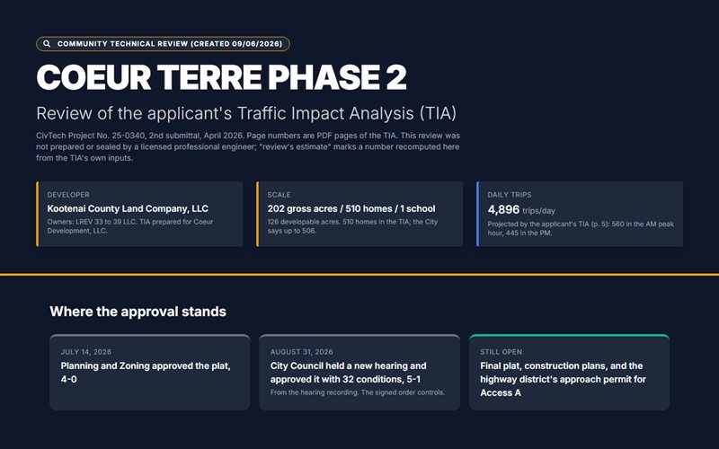
Technical Review Infographic
A visual summary of the review's findings and figures.
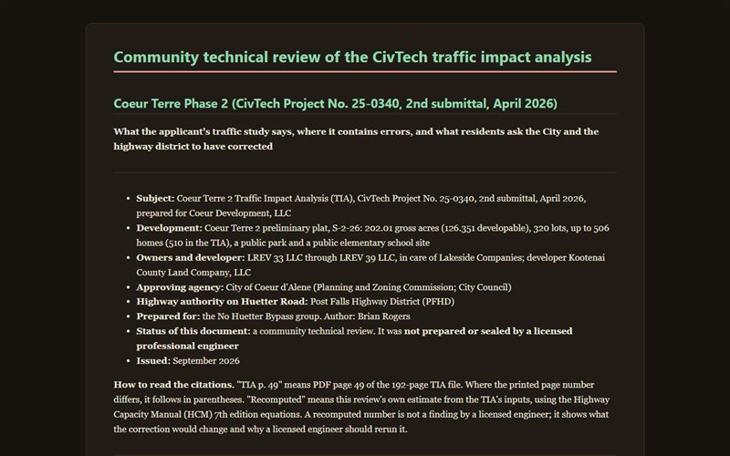
Community Technical Review (full report)
The full report: who has authority over Huetter Road, the data-entry error at Huetter and Mullan, the 2035 median-storage question, a roundabout check, east-side impacts, a risk ledger, and recommended conditions.